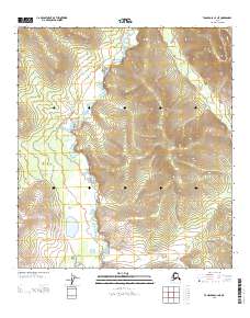
2013 Map of Tanacross C-4 NE
USGS Topo · Published 2013About this map
W Fork Dennison Fork defines the central axis of this landscape, winding through the Interior's vast wilderness within the Southeast Fairbanks census area. The waterway’s meandering path and the surrounding tight contour lines illustrate the dramatic elevation changes characteristic of this subarctic terrain. The 2013 survey emphasizes the natural hydrography of the region, showing how the fork carves through the land before merging with broader river systems downstream. This map is primarily a study of topography and drainage patterns, documenting a remote stretch of the Alaska interior where human development and established roads are entirely absent from the landscape, leaving only the complex network of ridges and the singular presence of the West Fork.
Find a feature on this map
4 named features on this map. Tap any name to fly to it.
Don’t see what you’re looking for? This feature index may not catch every label — zoom into the map to look around manually.
Map Details
Editions of this 2013 Tanacross C-4 NE Map
This is the sole edition of this map. No revisions or reprints were ever made.
Other maps of this area

1949 · Tanacross
USGS Topo · 1:250,000

1950 · Tanacross
USGS Topo · 1:250,000

1956 · Tanacross D-3
USGS Topo · 1:63,360

1956 · Tanacross C-3
USGS Topo · 1:63,360

1956 · Tanacross D-4
USGS Topo · 1:63,360
1956 · Tanacross C-4
USGS Topo · 1:63,360

1956 · Tanacross
USGS Topo · 1:250,000

1964 · Tanacross
USGS Topo · 1:250,000
2013 · Tanacross C-4 NW
USGS Topo · 1:25,000
2013 · Tanacross D-4 SW
USGS Topo · 1:25,000