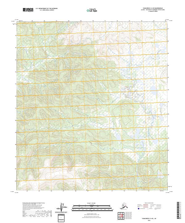
2024 Map of Tanacross C-6 SE
USGS Topo · Published 2024About this map
Mansfield Creek meanders through this undeveloped landscape in the Southeast Fairbanks Census Area, creating a complex wetland system as it flows south. This modern survey illustrates a remote wilderness defined by steep topographic relief, with several high ridges and valleys largely untouched by roads or human infrastructure. The hydrology and contour data reveal how water drainage patterns follow the natural terrain, particularly in the northern reaches where small tributaries feed into the larger creek valley. This area represents a quiet, pristine section of the Alaska interior where the natural environment remains the primary feature on the land.
Find a feature on this map
5 named features on this map. Tap any name to fly to it.
Don’t see what you’re looking for? This feature index may not catch every label — zoom into the map to look around manually.
Map Details
Editions of this 2024 Tanacross C-6 SE Map
This is the sole edition of this map. No revisions or reprints were ever made.
Other maps of this area

1948 · Tanacross B-5
USGS Topo · 1:63,360

1949 · Tanacross
USGS Topo · 1:250,000

1949 · Tanacross B-6
USGS Topo · 1:63,360

1950 · Tanacross
USGS Topo · 1:250,000

1951 · Tanacross B-6
USGS Topo · 1:63,360

1952 · Tanacross B-5
USGS Topo · 1:63,360

1954 · Tanacross C-6
USGS Topo · 1:63,360
1955 · Tanacross C-6
USGS Topo · 1:63,360
1956 · Tanacross C-5
USGS Topo · 1:63,360

1956 · Tanacross
USGS Topo · 1:250,000