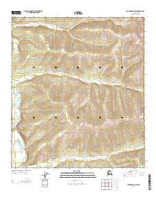
2013 Map of Tanacross D-2 SW
USGS Topo · Published 2013About this map
Dennison Fork winds through this interior Alaskan landscape, a region defined by its isolation and steep drainage networks. The topography is marked by significant elevation changes, with tributaries such as Cement Cr and Big Timber Cr cutting through the terrain. In the southwest corner of the sheet, a Winter Trl provides a rare indication of human passage, suggesting a landscape where travel was seasonally dependent and tied to the cycles of the northern climate. This 2013 survey illustrates a sparsely populated wilderness where the hydrology of the Tanacross region remains the primary geographic feature, long after the earliest trails were established for inland transit.
Find a feature on this map
6 named features on this map. Tap any name to fly to it.
Don’t see what you’re looking for? This feature index may not catch every label — zoom into the map to look around manually.
Map Details
Editions of this 2013 Tanacross D-2 SW Map
This is the sole edition of this map. No revisions or reprints were ever made.
Other maps of this area

1949 · Tanacross
USGS Topo · 1:250,000

1950 · Tanacross
USGS Topo · 1:250,000

1956 · Tanacross D-3
USGS Topo · 1:63,360

1956 · Tanacross D-2
USGS Topo · 1:63,360

1956 · Tanacross C-3
USGS Topo · 1:63,360

1956 · Tanacross C-2
USGS Topo · 1:63,360

1956 · Tanacross
USGS Topo · 1:250,000

1964 · Tanacross
USGS Topo · 1:250,000
2013 · Tanacross D-2 SE
USGS Topo · 1:25,000
2013 · Tanacross C-2 NW
USGS Topo · 1:25,000