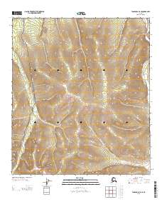
2013 Map of Tanacross D-3 SE
USGS Topo · Published 2013About this map
Taylor Hwy snakes through the western portion of this interior Alaska landscape, providing a critical transportation link between remote settlements. The terrain is defined by the winding course of Logging Cabin Creek, which flows through the heart of the area before meeting larger water bodies to the south. Along the eastern edge, the Dennison Fork carves a path through the hills, illustrating the drainage patterns that dominate the Southeast Fairbanks region. A Winter Trl branches off into the high ground, a feature essential for travel in this subarctic climate when the ground is frozen. This map documents the intersection of sparse roadway infrastructure and the natural hydrology of the Tanacross region during the early twenty-first century.
Find a feature on this map
7 named features on this map. Tap any name to fly to it.
Don’t see what you’re looking for? This feature index may not catch every label — zoom into the map to look around manually.
Map Details
Editions of this 2013 Tanacross D-3 SE Map
This is the sole edition of this map. No revisions or reprints were ever made.
Other maps of this area

1949 · Tanacross
USGS Topo · 1:250,000

1950 · Tanacross
USGS Topo · 1:250,000

1956 · Tanacross D-3
USGS Topo · 1:63,360

1956 · Tanacross D-2
USGS Topo · 1:63,360

1956 · Tanacross C-3
USGS Topo · 1:63,360

1956 · Tanacross C-2
USGS Topo · 1:63,360

1956 · Tanacross
USGS Topo · 1:250,000

1964 · Tanacross
USGS Topo · 1:250,000
2013 · Tanacross D-2 SW
USGS Topo · 1:25,000
2013 · Tanacross C-2 NW
USGS Topo · 1:25,000