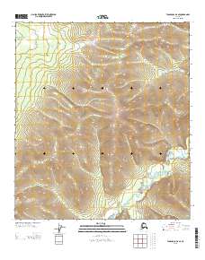
2013 Map of Tanacross D-4 SE
USGS Topo · Published 2013About this map
W Fork Dennison Fork winds through the southeastern corner of this Fairbanks region, its tight meanders carving through the drainage basin of the Tanacross area. The terrain is defined by the high pass at Balls Pass, which sits at the divide between several unnamed ridgelines. This 2013 survey illustrates a landscape primarily shaped by glacial and fluvial action, where the drainage pattern of the W Fork Dennison Fork is the dominant geographical marker. The absence of roads or established settlements on the sheet highlights the topographic focus on natural elevation and watercourses, providing an exact record of the high-altitude wilderness before further modern infrastructure or environmental changes might alter the landscape.
Find a feature on this map
4 named features on this map. Tap any name to fly to it.
Don’t see what you’re looking for? This feature index may not catch every label — zoom into the map to look around manually.
Map Details
Editions of this 2013 Tanacross D-4 SE Map
This is the sole edition of this map. No revisions or reprints were ever made.
Other maps of this area

1949 · Tanacross
USGS Topo · 1:250,000

1950 · Tanacross
USGS Topo · 1:250,000

1956 · Tanacross D-3
USGS Topo · 1:63,360

1956 · Tanacross C-3
USGS Topo · 1:63,360

1956 · Tanacross D-4
USGS Topo · 1:63,360
1956 · Tanacross C-4
USGS Topo · 1:63,360

1956 · Tanacross
USGS Topo · 1:250,000

1964 · Tanacross
USGS Topo · 1:250,000
2013 · Tanacross C-4 NE
USGS Topo · 1:25,000
2013 · Tanacross C-4 NW
USGS Topo · 1:25,000