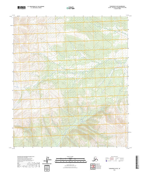
2024 Map of Tanacross D-6 NE
USGS Topo · Published 2024About this map
Mosquito Fork winds through a vast expanse of subarctic lowlands and rolling terrain in this northern interior region of Alaska. The landscape is defined by the sinuous path of the river and the presence of Billy Creek to the south, highlighting a wilderness character largely undisturbed by modern infrastructure. These waterways serve as the primary geographical anchors in a territory dominated by complex wetland systems and elevation contours that suggest a diverse mosaic of muskeg and boreal forest. The absence of roads or named settlements underscores the remoteness of the Southeast Fairbanks area, where the Public Land Survey System grid provides the only human-imposed framework over the natural hydrography. For those studying the hydrology of the Tanacross region, the detailed drainage patterns of these forks offer insight into the seasonal flow and landform evolution of the upper Tanana River basin.
Find a feature on this map
10 named features on this map. Tap any name to fly to it.
Don’t see what you’re looking for? This feature index may not catch every label — zoom into the map to look around manually.
Map Details
Editions of this 2024 Tanacross D-6 NE Map
This is the sole edition of this map. No revisions or reprints were ever made.
Other maps of this area

1949 · Tanacross
USGS Topo · 1:250,000

1950 · Tanacross
USGS Topo · 1:250,000

1951 · Eagle
USGS Topo · 1:250,000

1954 · Tanacross D-6
USGS Topo · 1:63,360
1955 · Tanacross D-6
USGS Topo · 1:63,360

1956 · Eagle A-5
USGS Topo · 1:63,360
1956 · Tanacross D-5
USGS Topo · 1:63,360

1956 · Eagle A-6
USGS Topo · 1:63,360

1956 · Tanacross
USGS Topo · 1:250,000

1957 · Eagle
USGS Topo · 1:250,000