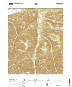
2017 Map of Tanana B-1 NE
USGS Topo · Published 2017About this map
Rampart sits along the southern bank of the Yukon River, serving as a central point of settlement in this northern interior region of Alaska. The landscape is defined by a dense network of watercourses and gravel bars, indicating a history of gold-bearing potential and seasonal river activity. Significant drainages like Minook Cr and its tributaries, including Little Minook Cr and Little Minook Junior Cr, flow through narrow valleys toward the Yukon. The presence of several named bars, such as Yukon Bar, Idaho Bar, California Bar, and McDonald Bar, highlights the importance of the river shoreline for navigation and potential resource extraction. High-elevation terrain is marked by features like Montana Gulch, while connectivity is provided by the Minook Creek Road, which follows the contours of the primary creek valley south of the settlement.
Find a feature on this map
29 named features on this map. Tap any name to fly to it.
Don’t see what you’re looking for? This feature index may not catch every label — zoom into the map to look around manually.
Map Details
Editions of this 2017 Tanana B-1 NE Map
This is the sole edition of this map. No revisions or reprints were ever made.
Other maps of this area

1945 · Livengood
USGS Topo · 1:250,000

1951 · Tanana
USGS Topo · 1:250,000

1951 · Livengood
USGS Topo · 1:250,000

1956 · Tanana B-1
USGS Topo · 1:63,360

1956 · Tanana C-1
USGS Topo · 1:63,360

1956 · Livengood B-6
USGS Topo · 1:63,360

1956 · Livengood C-6
USGS Topo · 1:63,360

1956 · Livengood
USGS Topo · 1:250,000

1956 · Tanana
USGS Topo · 1:250,000

1960 · Tanana
USGS Topo · 1:250,000