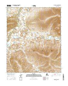
2016 Map of Tanana C-6 NW
USGS Topo · Published 2016About this map
The Melozitna River meanders through the northwest corner of this sub-arctic landscape, defining the local drainage patterns alongside smaller tributaries like Klatakhna Cr. This topographic study reveals a terrain of significant elevation changes, most notably at Nuklauket Pass, which serves as a natural gateway between the high ridges. The map captures the hydrological network of the Yukon-Koyukuk region, where Haha Cr and other seasonal waters carve through the township and range divisions. This 2016 data provides a precise view of the remote wilderness character of interior Alaska, documenting the natural landmarks and watercourses that have served as primary geographic markers for generations of travelers and land managers in the Tanana region.
Find a feature on this map
10 named features on this map. Tap any name to fly to it.
Don’t see what you’re looking for? This feature index may not catch every label — zoom into the map to look around manually.
Map Details
Editions of this 2016 Tanana C-6 NW Map
This is the sole edition of this map. No revisions or reprints were ever made.
Other maps of this area

1951 · Melozitna
USGS Topo · 1:250,000

1951 · Tanana
USGS Topo · 1:250,000

1952 · Melozitna D-1
USGS Topo · 1:63,360

1956 · Melozitna C-1
USGS Topo · 1:63,360

1956 · Tanana C-6
USGS Topo · 1:63,360

1956 · Tanana D-6
USGS Topo · 1:63,360

1956 · Melozitna
USGS Topo · 1:250,000

1956 · Tanana
USGS Topo · 1:250,000

1960 · Tanana
USGS Topo · 1:250,000
2016 · Tanana C-6 NE
USGS Topo · 1:25,000