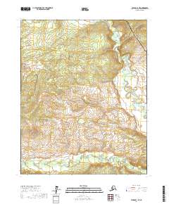
2017 Map of Tanana D-1 NE
USGS Topo · Published 2017About this map
The Alaska Pipeline cuts a distinct industrial line across this remote section of the Yukon-Koyukuk region, providing a sharp contrast to the wandering drainages of the Ray River and the Big Salt River. This 2017 survey documents a landscape defined by the intersection of critical energy infrastructure and a complex hydrological network. The terrain is marked by the winding course of the Ray River as it moves through the northeastern quadrant, while the Big Salt River establishes the southern boundary of the map. The spatial relationship between the pipeline corridor and these waterways highlights the engineering considerations required to traverse this interior Alaskan environment during the early 21st century.
Find a feature on this map
9 named features on this map. Tap any name to fly to it.
Don’t see what you’re looking for? This feature index may not catch every label — zoom into the map to look around manually.
Map Details
Editions of this 2017 Tanana D-1 NE Map
This is the sole edition of this map. No revisions or reprints were ever made.
Other maps of this area

1945 · Livengood
USGS Topo · 1:250,000

1951 · Bettles
USGS Topo · 1:250,000

1951 · Tanana
USGS Topo · 1:250,000

1951 · Livengood
USGS Topo · 1:250,000

1951 · Beaver
USGS Topo · 1:250,000

1956 · Bettles
USGS Topo · 1:250,000

1956 · Beaver
USGS Topo · 1:250,000

1956 · Livengood D-6
USGS Topo · 1:63,360

1956 · Tanana D-1
USGS Topo · 1:63,360

1956 · Livengood
USGS Topo · 1:250,000