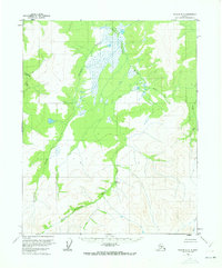
1956 Map of Tanana D-3
USGS Topo · Published 1973About this map
The Kanuti Kilolitna River dominates this interior Alaska landscape as it was documented in the mid-1950s, weaving through a wilderness defined by its drainage basins and isolated thermal activity. A standout geographical feature is the Kilo Hot Spring, located in the central portion of the map where the river valley narrows. This 1956 survey, based on aerial photography from 1953, illustrates a pristine subarctic environment largely untouched by permanent settlement or infrastructure, as indicated by the note that no roads or trails existed in the area at the time of mapping. Hydrological patterns are the primary focus, with the Torment Creek and Ishtalitna Creek feeding into the main valley from the west, while the Ray River and Halu Creek mark the eastern reaches. The lack of cultural features emphasizes the territory's character as a remote wilderness during the mid-twentieth century.
Find a feature on this map
7 named features on this map. Tap any name to fly to it.
Don’t see what you’re looking for? This feature index may not catch every label — zoom into the map to look around manually.
Map Details
Editions of this 1956 Tanana D-3 Map
2 editions found
Other maps of this area

1951 · Bettles
USGS Topo · 1:250,000

1951 · Tanana
USGS Topo · 1:250,000

1956 · Bettles
USGS Topo · 1:250,000

1956 · Tanana D-2
USGS Topo · 1:63,360

1956 · Tanana D-4
USGS Topo · 1:63,360

1956 · Tanana D-3
USGS Topo · 1:63,360

1956 · Tanana C-3
USGS Topo · 1:63,360

1956 · Tanana C-2
USGS Topo · 1:63,360

1956 · Tanana C-4
USGS Topo · 1:63,360

1956 · Tanana
USGS Topo · 1:250,000