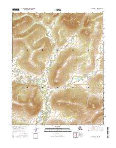
2016 Map of Tanana D-6 NW
USGS Topo · Published 2016About this map
Melozitna River meanders through a complex network of wetlands and low-lying drainages in this interior Alaska wilderness. The landscape is defined by the transition from the river valley's riparian corridors to the rising elevations of the Slokhenjikh Hills in the southeast. Smaller tributaries like Sithdonit Cr feed into the primary river system, creating a dense pattern of water bodies and marshy terrain typical of the Yukon-Koyukuk region. This 2016 survey provides a precise accounting of the hydrological features and topographic relief within several townships, including t13n r25w and t14n r26w. The lack of man-made infrastructure or settlements underscores the untouched character of the area, where the river remains the primary geographic anchor.
Find a feature on this map
9 named features on this map. Tap any name to fly to it.
Don’t see what you’re looking for? This feature index may not catch every label — zoom into the map to look around manually.
Map Details
Editions of this 2016 Tanana D-6 NW Map
This is the sole edition of this map. No revisions or reprints were ever made.
Other maps of this area

1951 · Hughes
USGS Topo · 1:250,000

1951 · Melozitna
USGS Topo · 1:250,000

1951 · Bettles
USGS Topo · 1:250,000

1951 · Tanana
USGS Topo · 1:250,000

1952 · Melozitna D-1
USGS Topo · 1:63,360

1955 · Hughes A-1
USGS Topo · 1:63,360

1956 · Hughes
USGS Topo · 1:250,000

1956 · Bettles
USGS Topo · 1:250,000

1956 · Tanana D-6
USGS Topo · 1:63,360

1956 · Melozitna
USGS Topo · 1:250,000