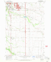
1969 Map of Tangent
USGS Topo · Published 1971About this map
Albany’s southern expansion and the surrounding Linn County farmlands are documented here in the late 1960s, showing a landscape defined by its irrigation and transportation networks. The Santiam Canal and numerous smaller waterways like Periwinkle Creek and Oak Creek cut through the level terrain, supporting the agricultural base of the Willamette Valley. The southern industrial and residential edges of Albany feature a high concentration of educational institutions, including Albany Union HS and Calapooya Jr High Sch, reflecting the community's mid-century growth. To the south, the village of Tangent serves as a local hub along the Southern Pacific railroad line. This survey captures the rural character of the area before modern suburban intensification, preserving the locations of numerous country schools like McFarland Sch and Price Sch that once anchored these farming districts.
Find a feature on this map
39 named features on this map. Tap any name to fly to it.
Don’t see what you’re looking for? This feature index may not catch every label — zoom into the map to look around manually.
Map Details
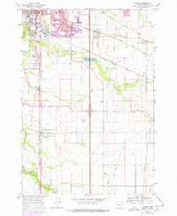
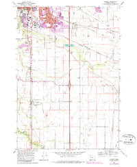
Editions of this 1969 Tangent Map
3 editions found
Other maps of this area

1911 · Brownsville
USGS Topo · 1:31,680

1911 · Lebanon
USGS Topo · 1:31,680

1911 · Tangent
USGS Topo · 1:31,680

1912 · Jefferson
USGS Topo · 1:31,680

1912 · Halsey
USGS Topo · 1:62,500

1913 · Oakville
USGS Topo · 1:31,680

1913 · Wells
USGS Topo · 1:31,680

1916 · Albany
USGS Topo · 1:62,500

1921 · Brownsville
USGS Topo · 1:62,500

1921 · Lebanon
USGS Topo · 1:62,500