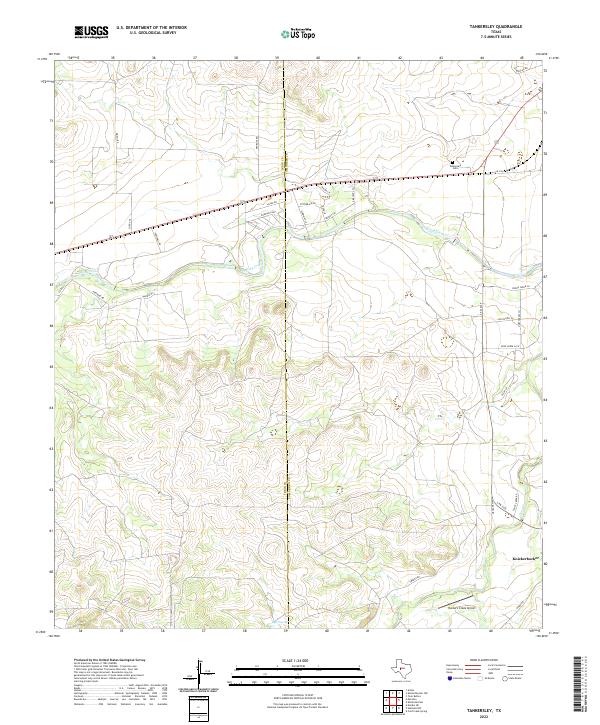
2022 Map of Tankersley
USGS Topo · Published 2022About this map
Spring Creek meanders eastward across this Central Texas landscape, defining the topography of the boundary between Irion and Tom Green counties. The settlement of Knickerbocker sits in the southeastern corner, serving as a focal point for local history along with the nearby Tankersley Cem, which preserves the names of early ranching families. The transportation network is a mix of modern infrastructure and rural tradition, with the paved corridor of S Fm 2335 connecting remote properties to larger hubs.
Find a feature on this map
35 named features on this map. Tap any name to fly to it.
Don’t see what you’re looking for? This feature index may not catch every label — zoom into the map to look around manually.
Map Details
Editions of this 2022 Tankersley Map
This is the sole edition of this map. No revisions or reprints were ever made.
Other maps of this area

1895 · Sherwood
USGS Topo · 1:125,000

1924 · Sherwood 1-d
USGS Topo · 1:48,000

1924 · Sherwood 1-a
USGS Topo · 1:48,000

1928 · Tankersly
USGS Topo · 1:62,500

1954 · San Angelo
USGS Topo · 1:250,000

1957 · Twin Buttes
USGS Topo · 1:24,000

1957 · Knickerbocker
USGS Topo · 1:62,500

1958 · San Angelo
USGS Topo · 1:250,000

1965 · San Angelo
USGS Topo · 1:250,000

1972 · Arden
USGS Topo · 1:24,000