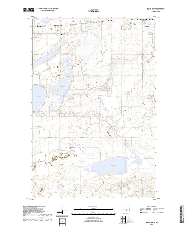
2024 Map of Tappen South
USGS Topo · Published 2024About this map
Slade National Wildlife Refuge anchors this section of the Prairie Pothole Region, protecting a complex of glacial water bodies including Upper Harker Lake, Harker Lake, and Lake Isabel. The landscape is defined by these shallow basins and the section-line road grid that organizes the surrounding agricultural plains. Local history is preserved at the Dawson Cem and Koestler Cem, which serve as quiet markers of the early families who settled these townships. In the northern corner, the outskirts of Tappen sit along the rail corridor, while the southern reaches are dedicated to conservation through the Kidder County Waterfowl Production Area. This 2024 survey illustrates the ongoing balance between the region's waterfowl habitat and the persistent grid of rural infrastructure like 38th St SE and 35th Ave SE.
Find a feature on this map
33 named features on this map. Tap any name to fly to it.
Don’t see what you’re looking for? This feature index may not catch every label — zoom into the map to look around manually.
Map Details
Editions of this 2024 Tappen South Map
This is the sole edition of this map. No revisions or reprints were ever made.
Other maps of this area

1952 · Tappen South
USGS Topo · 1:24,000

1952 · Tappen SE
USGS Topo · 1:24,000

1952 · Tappen NE
USGS Topo · 1:24,000

1952 · Dawson
USGS Topo · 1:24,000

1952 · Tappen North
USGS Topo · 1:24,000

1952 · Steele NE
USGS Topo · 1:24,000

1953 · Jamestown
USGS Topo · 1:250,000

1956 · Jamestown
USGS Topo · 1:250,000
1975 · Tappen North
USGS Topo · 1:24,000

1979 · Kintyre NE
USGS Topo · 1:24,000