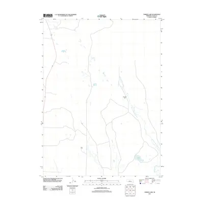
2011 Map of Tarbox Lake
USGS Topo · Published 2011About this map
Miles Ranch stands as a primary point of human interest in this corner of Logan County, characterized by the wide, winding valleys of the Sandhills region. The landscape is defined by the braided path of the South Loup River and its various branches, including the North Fork South Loup River and the N Fork South Loup River. These watercourses carve through the terrain, most notably at Shanklin Bluff, which provides a distinct vertical contrast to the surrounding river bottoms. The presence of Tarbox Lake and numerous smaller, unnamed wetlands indicates a high water table typical of this Nebraska ranching country, where the economy and settlement patterns are dictated by the availability of water and the natural contours of the valley floor.
Find a feature on this map
6 named features on this map. Tap any name to fly to it.
Don’t see what you’re looking for? This feature index may not catch every label — zoom into the map to look around manually.
Map Details
Editions of this 2011 Tarbox Lake Map
This is the sole edition of this map. No revisions or reprints were ever made.
Other maps of this area

1899 · North Platte
USGS Topo · 1:125,000

1902 · North Platte
USGS Topo · 1:125,000

1949 · Cody Lake
USGS Topo · 1:62,500

1951 · Cody Lake
USGS Topo · 1:62,500

1951 · Hoagland
USGS Topo · 1:62,500

1954 · North Platte
USGS Topo · 1:250,000

1956 · North Platte
USGS Topo · 1:250,000

1957 · North Platte
USGS Topo · 1:250,000

1967 · North Platte
USGS Topo · 1:250,000
1972 · Stapleton
USGS Topo · 1:24,000