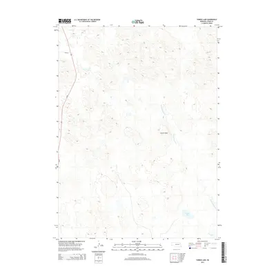
2014 Map of Tarbox Lake
USGS Topo · Published 2014About this map
N Fork S Loup River winds through the sandhills of Logan County, shaping the local topography as it approaches its confluence with the S Loup River. The landscape is defined by the winding hydrology of the region, including the notable Tarbox Lake and the elevation of Shanklin Bluff. Human passage through this rural Nebraska expanse is primarily facilitated by Us-83, which runs along the western edge of the quadrangle. The map reveals a sparsely populated terrain where drainage patterns and natural landmarks like Lanka Rd serve as the primary markers of location. This data, captured in the early 2010s, illustrates the relationship between the river system and the surrounding prairie, highlighting the few permanent landmarks in a region largely defined by its natural hydrology.
Find a feature on this map
6 named features on this map. Tap any name to fly to it.
Don’t see what you’re looking for? This feature index may not catch every label — zoom into the map to look around manually.
Map Details
Editions of this 2014 Tarbox Lake Map
This is the sole edition of this map. No revisions or reprints were ever made.
Other maps of this area

1899 · North Platte
USGS Topo · 1:125,000

1902 · North Platte
USGS Topo · 1:125,000

1949 · Cody Lake
USGS Topo · 1:62,500

1951 · Cody Lake
USGS Topo · 1:62,500

1951 · Hoagland
USGS Topo · 1:62,500

1954 · North Platte
USGS Topo · 1:250,000

1956 · North Platte
USGS Topo · 1:250,000

1957 · North Platte
USGS Topo · 1:250,000

1967 · North Platte
USGS Topo · 1:250,000
1972 · Stapleton
USGS Topo · 1:24,000