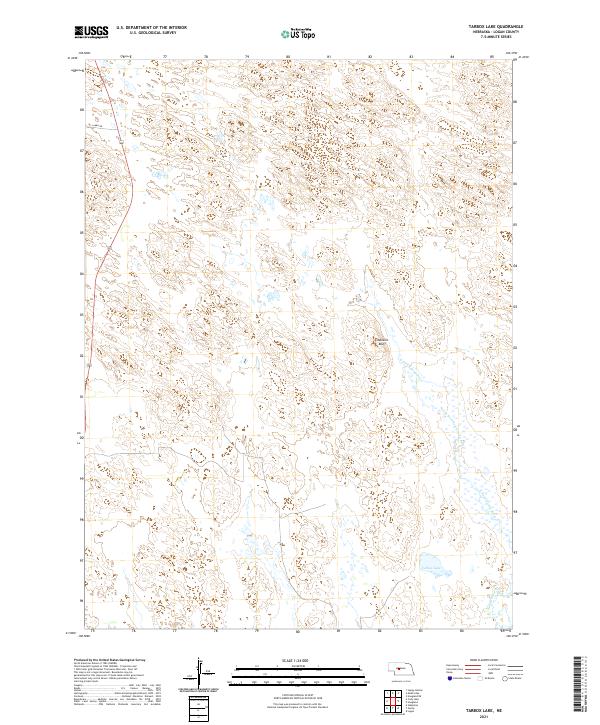
2021 Map of Tarbox Lake
USGS Topo · Published 2021About this map
N Fork S Loup River and the S Loup River define this Logan County landscape, where the Sandhills terrain is marked by intricate drainage patterns and small pockets of surface water. The topography is anchored by Shanklin Bluff, a notable elevation rise situated northwest of the map's namesake Tarbox Lake. This contemporary record reflects a sparsely settled ranching or agricultural region where the natural water systems remain the primary landmarks across the township lines of T19N and T18N. Remote access is facilitated by local routes like Lanka Rd, which cuts through the northwestern corner of the quadrangle. The map is a precise document for understanding the modern hydrology of the Loup River system, showing the numerous small wetlands and basins that characterize this part of Nebraska.
Find a feature on this map
9 named features on this map. Tap any name to fly to it.
Don’t see what you’re looking for? This feature index may not catch every label — zoom into the map to look around manually.
Map Details
Editions of this 2021 Tarbox Lake Map
This is the sole edition of this map. No revisions or reprints were ever made.
Other maps of this area

1899 · North Platte
USGS Topo · 1:125,000

1902 · North Platte
USGS Topo · 1:125,000

1949 · Cody Lake
USGS Topo · 1:62,500

1951 · Cody Lake
USGS Topo · 1:62,500

1951 · Hoagland
USGS Topo · 1:62,500

1954 · North Platte
USGS Topo · 1:250,000

1956 · North Platte
USGS Topo · 1:250,000

1957 · North Platte
USGS Topo · 1:250,000

1967 · North Platte
USGS Topo · 1:250,000
1972 · Stapleton
USGS Topo · 1:24,000