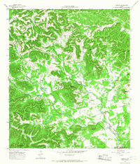
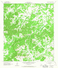
1964 Map of Tarpley
USGS Topo · Published 1968About this map
Tarpley serves as the primary focal point of this 1964 survey, situated at the confluence of several vital waterways in the Hill Country. The settlement's connection to the surrounding landscape is defined by the drainage patterns of Williams Creek, Hondo Creek, and Commissioners Creek. The terrain is characterized by a dense network of springs and named hollows, including Clement Springs and Dewberry Hollow, which supported the local ranching and agricultural economy.
Find a feature on this map
39 named features on this map. Tap any name to fly to it.
Don’t see what you’re looking for? This feature index may not catch every label — zoom into the map to look around manually.
Map Details
Editions of this 1964 Tarpley Map
2 editions found
Other maps of this area

1954 · San Antonio
USGS Topo · 1:250,000

1956 · Tarpley
USGS Topo · 1:62,500

1956 · Tuff
USGS Topo · 1:62,500

1956 · Bandera
USGS Topo · 1:62,500

1956 · Center Point
USGS Topo · 1:62,500

1957 · San Antonio
USGS Topo · 1:250,000
1964 · Love Creek
USGS Topo · 1:24,000

1964 · Rock Cliff Reservoir
USGS Topo · 1:24,000
1964 · A Bar A Ranch
USGS Topo · 1:24,000
1964 · Tarpley Pass
USGS Topo · 1:24,000