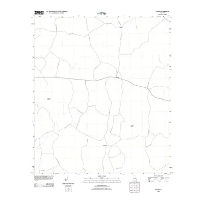
2011 Map of Tarver
USGS Topo · Published 2011About this map
Alexis and Tarver stand as the primary small settlements in this south Georgia landscape, connected by a network of rural roads such as County Hwy-121 and Barnes Rd. The terrain is characterized by its wetlands and unique naming conventions, notably featuring Buzzard Island and Whiskey Island, which rise above the surrounding drainage of Alligator Creek and Toms Creek. The transportation patterns, including labels for Harrison Ford Rd and Sandy Ford Rd, suggest historic river crossings that dictated early movement through the region. Further south, the settlement of Potter sits near a dense web of local tracks like Ricefield Rd and Alexander Rd, hinting at the agricultural and timber-based land use common to this part of the state in the early twenty-first century.
Find a feature on this map
27 named features on this map. Tap any name to fly to it.
Don’t see what you’re looking for? This feature index may not catch every label — zoom into the map to look around manually.
Map Details
Editions of this 2011 Tarver Map
This is the sole edition of this map. No revisions or reprints were ever made.
Other maps of this area

1954 · Valdosta
USGS Topo · 1:250,000

1955 · Jasper
USGS Topo · 1:24,000

1955 · Cypress Creek
USGS Topo · 1:24,000

1956 · Jennings
USGS Topo · 1:24,000

1958 · Valdosta
USGS Topo · 1:250,000

1959 · Valdosta
USGS Topo · 1:250,000

1971 · Thelma
USGS Topo · 1:24,000

1971 · Howell
USGS Topo · 1:24,000

1971 · Tarver
USGS Topo · 1:24,000
1971 · Pineland
USGS Topo · 1:24,000