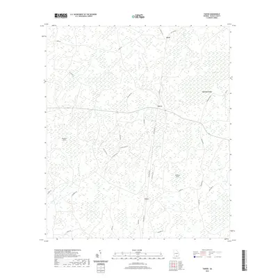
2020 Map of Tarver
USGS Topo · Published 2020About this map
Tarver, Alexis, and Potter define the sparse settlement pattern of this low-lying region in Echols County. The landscape is dominated by a complex network of wetlands and seasonal drainages, identified on the map as bays, including Beaverdam Bay, Tarver Bay, and the expansive Fiftythree Bay. These features, along with Little Rice Field and White Arm, suggest a history of specific land use adapted to the high water table and marshy soils of the Georgia coastal plain. Notable landmarks such as Buzzard Island and Whiskey Island rise slightly above the surrounding wetlands. The area is threaded by a network of local roads including Gaddis Rd, Haylow Rd, and New Barnes Rd, connecting these small communities across the humid, water-marked terrain of the southern frontier.
Find a feature on this map
39 named features on this map. Tap any name to fly to it.
Don’t see what you’re looking for? This feature index may not catch every label — zoom into the map to look around manually.
Map Details
Editions of this 2020 Tarver Map
This is the sole edition of this map. No revisions or reprints were ever made.
Other maps of this area

1954 · Valdosta
USGS Topo · 1:250,000

1955 · Jasper
USGS Topo · 1:24,000

1955 · Cypress Creek
USGS Topo · 1:24,000

1956 · Jennings
USGS Topo · 1:24,000

1958 · Valdosta
USGS Topo · 1:250,000

1959 · Valdosta
USGS Topo · 1:250,000

1971 · Thelma
USGS Topo · 1:24,000

1971 · Howell
USGS Topo · 1:24,000

1971 · Tarver
USGS Topo · 1:24,000
1971 · Pineland
USGS Topo · 1:24,000