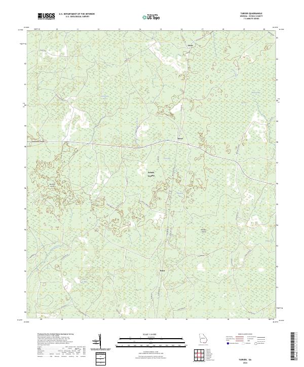
2024 Map of Tarver
USGS Topo · Published 2024About this map
Tarver and the surrounding piney lowlands of Echols County are defined by an intricate network of wetlands and seasonal water bodies. This 2024 landscape is characterized by its numerous bays, including Beaverdam Bay, Tarver Bay, and Fiftythree Bay, which serve as natural drainage and habitat zones within the flat terrain. Settlements like Alexis in the north and Potter to the south are linked by a grid of rural connectors such as Barnes RD and Haylow RD. The hydrology of the area is further marked by the presence of Toms Creek and the meandering Alligator Creek. Distinctive land features like Buzzard Island and Whiskey Island rise slightly above the surrounding marshes, while the label for Little Rice Field points to the area's agricultural history and land use patterns.
Find a feature on this map
39 named features on this map. Tap any name to fly to it.
Don’t see what you’re looking for? This feature index may not catch every label — zoom into the map to look around manually.
Map Details
Editions of this 2024 Tarver Map
This is the sole edition of this map. No revisions or reprints were ever made.
Other maps of this area

1954 · Valdosta
USGS Topo · 1:250,000

1955 · Jasper
USGS Topo · 1:24,000

1955 · Cypress Creek
USGS Topo · 1:24,000

1956 · Jennings
USGS Topo · 1:24,000

1958 · Valdosta
USGS Topo · 1:250,000

1959 · Valdosta
USGS Topo · 1:250,000

1971 · Thelma
USGS Topo · 1:24,000

1971 · Howell
USGS Topo · 1:24,000

1971 · Tarver
USGS Topo · 1:24,000
1971 · Pineland
USGS Topo · 1:24,000