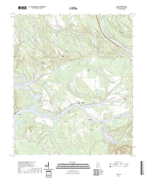
2024 Map of Tasso
USGS Topo · Published 2024About this map
Tasso and the surrounding rural landscape of Dallas County are defined by the winding course of the Alabama River and its major tributaries, including Big Swamp Creek and Bogue Chitto Creek. The settlement pattern reflects the area's agricultural and river-based heritage, with small communities like Pinebelt, Portland, and Ellis connected by a network of county roads. Long-standing family and community connections are preserved in the locations of several burial grounds, such as New Bethel Cem and the McMillan Cem. Navigation along the river is marked by numerous sandbars and bends, including Rifleman Bar, Middle Sister Bar, and the prominent Molette Bend. A historical river crossing is noted at Halls Ferry, indicating where travel once relied on water transport rather than modern bridges. The terrain is characterized by the convergence of several large creeks, such as Pine Barren Creek and Oak Creek, which drain the lowlands before joining the primary river channel.
Find a feature on this map
64 named features on this map. Tap any name to fly to it.
Don’t see what you’re looking for? This feature index may not catch every label — zoom into the map to look around manually.
Map Details
Editions of this 2024 Tasso Map
This is the sole edition of this map. No revisions or reprints were ever made.
Other maps of this area

1953 · Montgomery
USGS Topo · 1:250,000

1956 · Montgomery
USGS Topo · 1:250,000

1957 · Montgomery
USGS Topo · 1:250,000

1957 · Carlowville
USGS Topo · 1:62,500

1958 · Selma
USGS Topo · 1:62,500

1968 · Safford
USGS Topo · 1:24,000

1974 · Crumptonia
USGS Topo · 1:24,000
1974 · Camden North
USGS Topo · 1:24,000

1975 · Selma SE
USGS Topo · 1:24,000

1975 · Carlowville NE
USGS Topo · 1:24,000