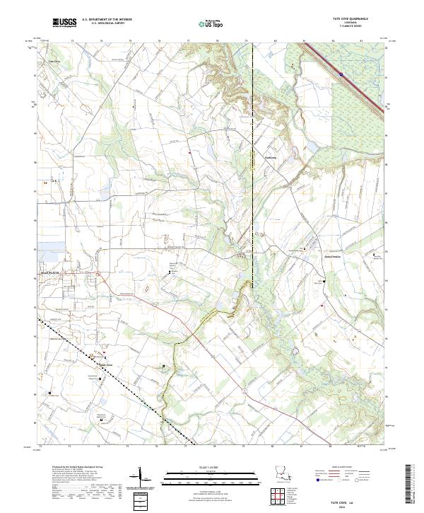
2024 Map of Tate Cove
USGS Topo · Published 2024About this map
The Acadiana landscape north of the parish seat at Ville Platte is defined by a dense network of coulees and bayous that shaped early French-Acadian settlement patterns. At the boundary of Evangeline Parish and St. Landry Parish, the terrain transitions from the intricate bottomlands of Bayou Petite Passe to the eastern wetlands of Bayou Cocodrie. This 2024 map documents several persistent rural communities, including Faubourg, Grand Prairie, and the namesake Tate Cove, each anchored by local churches and family cemeteries.
Find a feature on this map
123 named features on this map. Tap any name to fly to it.
Don’t see what you’re looking for? This feature index may not catch every label — zoom into the map to look around manually.
Map Details
Editions of this 2024 Tate Cove Map
This is the sole edition of this map. No revisions or reprints were ever made.
Other maps of this area

1935 · Turkey Creek
USGS Topo · 1:62,500

1939 · Opelousas
USGS Topo · 1:62,500

1947 · Ville Platte
USGS Topo · 1:31,680

1947 · Chataignier
USGS Topo · 1:31,680

1948 · Bunkie
USGS Topo · 1:62,500

1949 · Turkey Creek
USGS Topo · 1:62,500

1952 · Lake Charles
USGS Topo · 1:250,000

1954 · Lake Charles
USGS Topo · 1:250,000

1956 · Opelousas
USGS Topo · 1:62,500

1957 · Opelousas
USGS Topo · 1:62,500