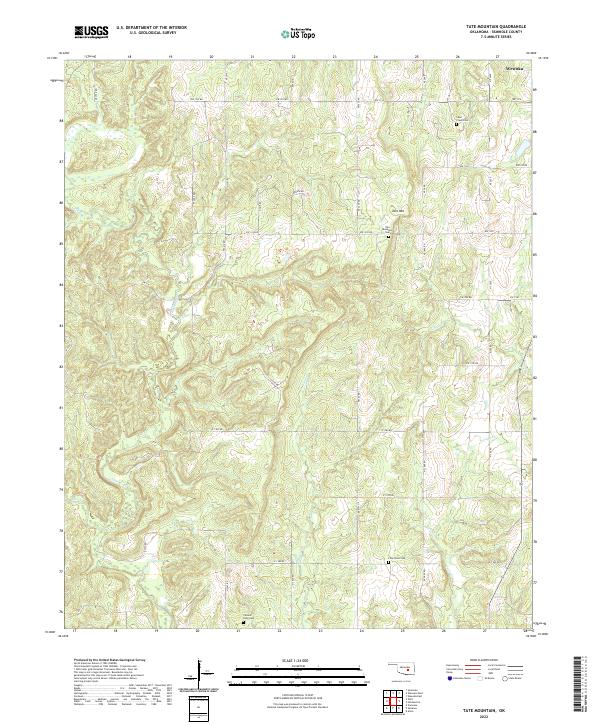
2022 Map of Tate Mountain
USGS Topo · Published 2022About this map
Little River and its various tributaries, including Salt Cr and Sand Cr, dictate the drainage patterns across this section of Seminole County. The terrain is defined by the prominent Tate Mtn in the northeastern quadrant, a local landmark that rises above the surrounding creek valleys. This modern survey illustrates the persistent rural footprint of the region, where a network of section-line roads like Ew 1330 RD and Ew 1310 RD provides access to scattered homesteads and family legacy sites. Genealogy is well-served here by the inclusion of several distinct burial grounds, such as Sand Creek Cem, Tate Mountain Cem, Lone Dove Cem, and Thomas Town Cem, which anchor the landscape to its historical community settlements and provide specific points of interest for researchers tracing local lineage.
Find a feature on this map
31 named features on this map. Tap any name to fly to it.
Don’t see what you’re looking for? This feature index may not catch every label — zoom into the map to look around manually.
Map Details
Editions of this 2022 Tate Mountain Map
This is the sole edition of this map. No revisions or reprints were ever made.
Other maps of this area

1896 · Seminole and Prague
USGS Topo · 1:125,000

1896 · Coalgate
USGS Topo · 1:125,000

1899 · Coalgate
USGS Topo · 1:125,000

1900 · Wewoka
USGS Topo · 1:125,000

1900 · Coalgate
USGS Topo · 1:125,000

1901 · Stonewall
USGS Topo · 1:125,000

1954 · Oklahoma City
USGS Topo · 1:250,000

1957 · Ardmore
USGS Topo · 1:250,000

1957 · Oklahoma City
USGS Topo · 1:250,000

1958 · Sasakwa
USGS Topo · 1:24,000