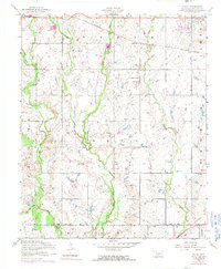
1956 Map of Taupa
USGS Topo · Published 1991About this map
Comanche County landscape at the edge of the Fort Sill Military Reservation is defined by a network of north-south drainage systems, including Blue Beaver Creek and Pecan Creek. The map documents small community anchors like the Deyo Memorial Chapel and the nearby Deyo Cemetery, which alongside Wesley Chapel and Pecan Cemetery, offer vital points of reference for genealogists tracing early families in this portion of Oklahoma. The agricultural and residential character of the era is punctuated by the presence of Huscher Field and the St Louis San Francisco railroad line, which skirts the northeastern corner near the settlement of Taupa. Significant infrastructure is marked along the Base Line road, while the Sunset Memorial Garden Cemetery sits near the northern boundary, providing a detailed record of local land use and community centers during the mid-twentieth century.
Find a feature on this map
19 named features on this map. Tap any name to fly to it.
Don’t see what you’re looking for? This feature index may not catch every label — zoom into the map to look around manually.
Map Details
Editions of this 1956 Taupa Map
3 editions found
Other maps of this area

1937 · Cache
USGS Topo · 1:48,000

1937 · Quanah Mountain
USGS Topo · 1:24,000

1942 · Cache
USGS Topo · 1:62,500

1946 · Lawton
USGS Topo · 1:62,500

1949 · Mount Scott
USGS Topo · 1:24,000

1949 · Quanah Mountain
USGS Topo · 1:24,000

1949 · Fort Sill
USGS Topo · 1:24,000

1955 · Lawton
USGS Topo · 1:250,000

1956 · Post Oak Creek
USGS Topo · 1:24,000
1956 · Quanah Mountain
USGS Topo · 1:24,000