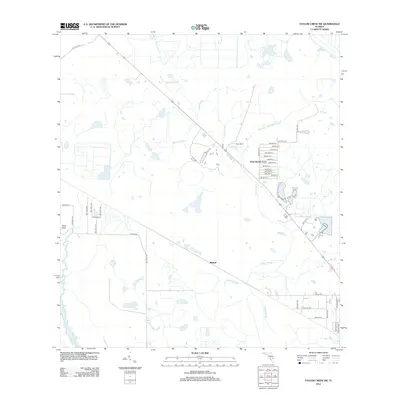
2012 Map of Taylor Creek SW
USGS Topo · Published 2012About this map
Dixie Ranch Acres serves as a primary residential focal point within this Okeechobee County landscape, characterized by a structured grid of rural avenues and courts such as NW 96th Ct and NW 80th Ave. The terrain is defined by its subtle drainage patterns and watercourses, including the westward-flowing Popash Slough and Turkey Slough, which weave through the prairie-like environment towards the Kissimmee River along the western boundary. Near the river, Platt Bluff provides a named topographical rise in an otherwise low-lying region. Smaller settlements and landmarks like Dixie Ranch and Mildred sit along the central diagonal corridor, while Chandler Hammock Slough and Sandfly Gully highlight the intricate natural hydrology that persists despite modern road development.
Find a feature on this map
45 named features on this map. Tap any name to fly to it.
Don’t see what you’re looking for? This feature index may not catch every label — zoom into the map to look around manually.
Map Details
Editions of this 2012 Taylor Creek SW Map
This is the sole edition of this map. No revisions or reprints were ever made.
Other maps of this area

1952 · Okeechobee NW
USGS Topo · 1:24,000

1952 · Okeechobee
USGS Topo · 1:24,000

1953 · Taylor Creek NW
USGS Topo · 1:24,000

1953 · Basinger
USGS Topo · 1:24,000

1953 · Fort Basinger
USGS Topo · 1:24,000

1953 · Brighton
USGS Topo · 1:24,000

1953 · Taylor Creek SW
USGS Topo · 1:24,000

1953 · Taylor Creek SE
USGS Topo · 1:24,000

1953 · Taylor Creek NE
USGS Topo · 1:24,000

1956 · Fort Pierce
USGS Topo · 1:250,000