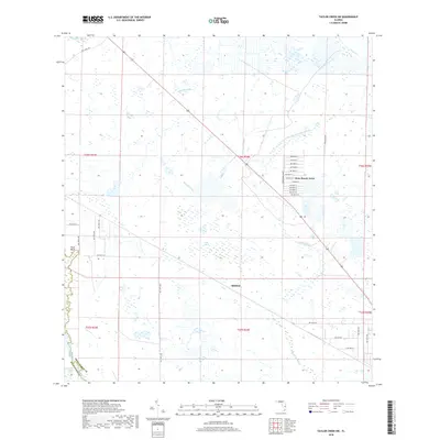
2018 Map of Taylor Creek SW
USGS Topo · Published 2018About this map
Dixie Ranch Acres serves as a primary residential focal point in this portion of the Florida interior, characterized by a structured grid of residential courts and avenues. The landscape is dominated by the intricate hydrology of the Kissimmee drainage basin, where the western edge is defined by the Kissimmee River and the eastern reaches are fed by Taylor Cr. The terrain between these water bodies is a complex network of seasonal waterways and wetlands, including Chandler Slough, Sandfly Gully, and Popash Slough. Small settlements like Mildred and Platt Bluff indicate the localized human footprint within a landscape largely defined by marshes and slashes, such as Yates Marsh and Long Cypress Slash. This survey captures the region as it functions for modern land management, showing the intersection of traditional wetlands with expanding rural subdivisions and the county boundary between Highlands and Okeechobee counties.
Find a feature on this map
46 named features on this map. Tap any name to fly to it.
Don’t see what you’re looking for? This feature index may not catch every label — zoom into the map to look around manually.
Map Details
Editions of this 2018 Taylor Creek SW Map
This is the sole edition of this map. No revisions or reprints were ever made.
Other maps of this area

1952 · Okeechobee NW
USGS Topo · 1:24,000

1952 · Okeechobee
USGS Topo · 1:24,000

1953 · Taylor Creek NW
USGS Topo · 1:24,000

1953 · Basinger
USGS Topo · 1:24,000

1953 · Fort Basinger
USGS Topo · 1:24,000

1953 · Brighton
USGS Topo · 1:24,000

1953 · Taylor Creek SW
USGS Topo · 1:24,000

1953 · Taylor Creek SE
USGS Topo · 1:24,000

1953 · Taylor Creek NE
USGS Topo · 1:24,000

1956 · Fort Pierce
USGS Topo · 1:250,000