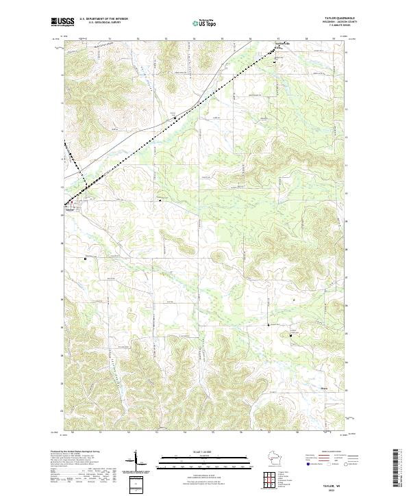
2022 Map of Taylor
USGS Topo · Published 2022About this map
The Trempealeau River winds through this Jackson County landscape, carving a wide valley flanked by several distinct coulees such as Skutley Coulee, Pete Coulee, and Curran Coulee. The settlement of Taylor sits in the west, while the communities of Hixton, Sechlerville, and Disco are distributed along the network of county highways and local roads. For genealogists, the map is particularly rich with burial sites, including Sechlerville Cem, Sherwood Cem, Woodlawn Cem, Colwell Cem, and French Creek Cem. The terrain is defined by the contrast between the flat river bottoms and the many drainage basins like Pine Cr and French Cr, which historically dictated the placement of homesteads and early transport routes through this part of west-central Wisconsin.
Find a feature on this map
84 named features on this map. Tap any name to fly to it.
Don’t see what you’re looking for? This feature index may not catch every label — zoom into the map to look around manually.
Map Details
Editions of this 2022 Taylor Map
This is the sole edition of this map. No revisions or reprints were ever made.
Other maps of this area

1924 · Black River Falls
USGS Topo · 1:62,500

1926 · Black River Falls
USGS Topo · 1:62,500

1926 · North Bend
USGS Topo · 1:62,500

1927 · Blair
USGS Topo · 1:62,500

1928 · Melrose
USGS Topo · 1:48,000

1929 · North Bend
USGS Topo · 1:62,500

1949 · Melrose
USGS Topo · 1:62,500

1953 · Eau Claire
USGS Topo · 1:250,000

1958 · Eau Claire
USGS Topo · 1:250,000

1964 · Eau Claire
USGS Topo · 1:250,000