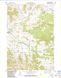
1984 Map of Taylor
USGS Topo · Published 1984About this map
The village of Taylor sits at the confluence of the Trempealeau River and local tributaries in this mid-1980s topographical study. The landscape is defined by its coulees—steep-walled valleys such as West Curran Coulee and Skutley Coulee—which channel the drainage of the region into the river system. Settlement patterns follow these natural contours, with roads like Rose Hill Road and Lincoln Road skirting the high ridges of the Albion and Springfield townships.
Find a feature on this map
58 named features on this map. Tap any name to fly to it.
Don’t see what you’re looking for? This feature index may not catch every label — zoom into the map to look around manually.
Map Details
Editions of this 1984 Taylor Map
This is the sole edition of this map. No revisions or reprints were ever made.
Other maps of this area

1924 · Black River Falls
USGS Topo · 1:62,500

1926 · Black River Falls
USGS Topo · 1:62,500

1926 · North Bend
USGS Topo · 1:62,500

1927 · Blair
USGS Topo · 1:62,500

1928 · Melrose
USGS Topo · 1:48,000

1929 · North Bend
USGS Topo · 1:62,500

1949 · Melrose
USGS Topo · 1:62,500

1953 · Eau Claire
USGS Topo · 1:250,000

1958 · Eau Claire
USGS Topo · 1:250,000

1964 · Eau Claire
USGS Topo · 1:250,000