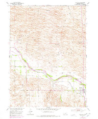
1952 Map of Taylor
USGS Topo · Published 1978About this map
The North Loup River valley dominates this mid-century survey, revealing a landscape defined by ranching and vital irrigation infrastructure in Loup County. The town of Taylor serves as the local hub, situated near the riverbanks where the Taylor-Ord Canal begins its course downstream. Irrigation is a central theme of this period, evidenced by the Taylor Dam and the complex system of canals and levees designed to manage the river's flow for agriculture.
Find a feature on this map
22 named features on this map. Tap any name to fly to it.
Don’t see what you’re looking for? This feature index may not catch every label — zoom into the map to look around manually.
Map Details
Editions of this 1952 Taylor Map
2 editions found
Other maps of this area

1951 · Walworth
USGS Topo · 1:24,000

1952 · Sargent East
USGS Topo · 1:24,000

1952 · Taylor NW
USGS Topo · 1:24,000

1952 · Almeria NE
USGS Topo · 1:24,000

1952 · Sargent West
USGS Topo · 1:24,000

1952 · Taylor SE
USGS Topo · 1:24,000

1952 · Almeria
USGS Topo · 1:24,000

1952 · Taylor
USGS Topo · 1:24,000

1952 · Taylor NE
USGS Topo · 1:24,000

1955 · Broken Bow
USGS Topo · 1:250,000