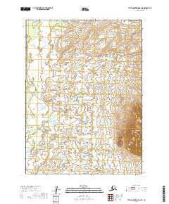
2019 Map of Taylor Mountains A-4 SE
USGS Topo · Published 2019About this map
Nushagak River curves through the northwestern corner of this interior Alaskan landscape, a region defined by its expansive hydrological network and solitary peaks. This 2019 survey captures the area in the Dillingham Census Area when it remained largely unsettled, dominated by a vast system of lakes and wetlands that stretch between the low-lying basins. The most prominent vertical landmark on this sheet is Sleitut Mtn, which rises in the southeast, providing a singular point of orientation amidst the surrounding plains. The survey layout follows the Public Land Survey System grids for t1s r47w, t1s r46w, t2s r47w, and t2s r46w, reflecting the ongoing efforts of the U.S. Geological Survey to document this remote terrain.
Find a feature on this map
6 named features on this map. Tap any name to fly to it.
Don’t see what you’re looking for? This feature index may not catch every label — zoom into the map to look around manually.
Map Details
Editions of this 2019 Taylor Mountains A-4 SE Map
This is the sole edition of this map. No revisions or reprints were ever made.
Other maps of this area

1950 · Taylor Mountains
USGS Topo · 1:250,000

1951 · Taylor Mountains
USGS Topo · 1:250,000

1951 · Dillingham
USGS Topo · 1:250,000

1954 · Taylor Mountains
USGS Topo · 1:250,000

1954 · Dillingham
USGS Topo · 1:250,000

1954 · Dillingham D-3
USGS Topo · 1:63,360

1954 · Taylor Mountains A-4
USGS Topo · 1:63,360

1954 · Dillingham D-4
USGS Topo · 1:63,360
1954 · Taylor Mountains A-3
USGS Topo · 1:63,360
2019 · Dillingham D-4 NE
USGS Topo · 1:25,000