
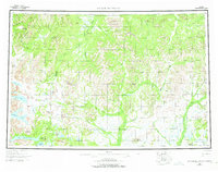
1954 Map of Taylor Mountains
USGS Topo · Published 1967About this map
The Kuskokwim River and the Nushagak River define the massive drainage systems of this Southwestern Alaska interior, where the Kuskokwim Mountains and Nushagak Hills meet. The landscape is characterized by a dense network of braided waterways and significant glacial lakes, including the sprawling Lake Chauekuktuli and Chikuminuk Lake. This area represents a critical watershed where the Holitna River and Hoholitna River flow north toward the Kuskokwim, while the Mulchatna River and Tikchik River drain south toward Bristol Bay.
Find a feature on this map
60 named features on this map. Tap any name to fly to it.
Don’t see what you’re looking for? This feature index may not catch every label — zoom into the map to look around manually.
Map Details
Editions of this 1954 Taylor Mountains Map
3 editions found
Other maps of this area

1946 · Lake Clark
USGS Topo · 1:250,000

1947 · Russian Mission
USGS Topo · 1:250,000

1950 · Russian Mission
USGS Topo · 1:250,000

1950 · Sleetmute
USGS Topo · 1:250,000

1950 · Bethel
USGS Topo · 1:250,000

1950 · Taylor Mountains
USGS Topo · 1:250,000

1951 · Lake Clark
USGS Topo · 1:250,000

1951 · Taylor Mountains
USGS Topo · 1:250,000

1951 · Lime Hills
USGS Topo · 1:250,000

1951 · Dillingham
USGS Topo · 1:250,000