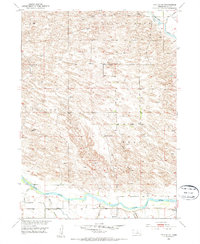
1952 Map of Taylor SE
USGS Topo · Published 1954About this map
The North Loup River winds through the southern reaches of this landscape, supported by an irrigation network that includes the Taylor-Oro Canal and a prominent Spoil Bank. In the early 1950s, this portion of Loup County remained defined by its rural school districts and rugged canyon terrain. Remote schoolhouses such as Lone Star Sch, Pleasant View Sch, and Round Hill Sch are scattered across the township lines, serving the elevated plateaus of Taylor and Kent. To the northeast, the Calamus River clips the corner of the survey near the Little York region. The topography is deeply etched by family-named landmarks like McCord Canyon, Bohys Canyon, and Leydell Canyon, which drain toward the river valley. This survey was conducted as part of the Department of the Interior program for the development of the Missouri River Basin, capturing the post-war infrastructure of Nebraska's sandhills and river breaks.
Find a feature on this map
18 named features on this map. Tap any name to fly to it.
Don’t see what you’re looking for? This feature index may not catch every label — zoom into the map to look around manually.
Map Details
Editions of this 1952 Taylor SE Map
2 editions found
Other maps of this area

1952 · Burwell
USGS Topo · 1:24,000

1952 · Sargent East
USGS Topo · 1:24,000

1952 · Taylor NW
USGS Topo · 1:24,000

1952 · Sargent West
USGS Topo · 1:24,000

1952 · Taylor SE
USGS Topo · 1:24,000

1952 · Comstock NW
USGS Topo · 1:24,000

1952 · Taylor
USGS Topo · 1:24,000

1952 · Burwell NW
USGS Topo · 1:24,000

1952 · Taylor NE
USGS Topo · 1:24,000

1955 · Broken Bow
USGS Topo · 1:250,000