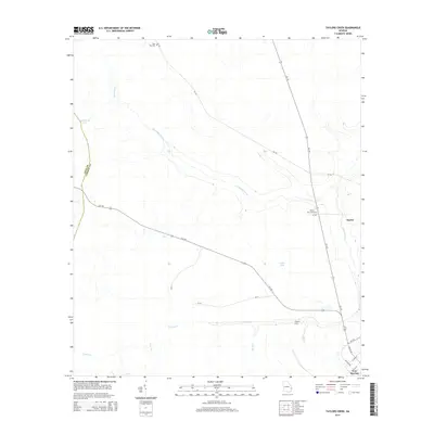
2014 Map of Taylors Creek
USGS Topo · Published 2014About this map
Fort Stewart dominates the southeastern portion of this Liberty County landscape, where the military installation meets the wetlands of the coastal plain. The terrain is defined by the wandering paths of Canoochee Creek and Taylors Creek, which feed into a network of smaller tributaries like Gum Br and Horse Cr. This environment of slow-moving water and low-lying land is punctuated by features like Cedar Bay and Strickland Pond, illustrating the hydrologic character of the region.
Find a feature on this map
28 named features on this map. Tap any name to fly to it.
Don’t see what you’re looking for? This feature index may not catch every label — zoom into the map to look around manually.
Map Details
Editions of this 2014 Taylors Creek Map
This is the sole edition of this map. No revisions or reprints were ever made.
Other maps of this area

1918 · Hinesville
USGS Topo · 1:62,500

1919 · Claxton
USGS Topo · 1:62,500

1920 · Pembroke
USGS Topo · 1:62,500

1920 · Glennville
USGS Topo · 1:62,500

1944 · Claxton
USGS Topo · 1:62,500

1944 · Glennville
USGS Topo · 1:62,500

1944 · Hinesville
USGS Topo · 1:62,500

1946 · Brunswick
USGS Topo · 1:250,000

1947 · Savannah
USGS Topo · 1:250,000

1948 · Brunswick
USGS Topo · 1:250,000