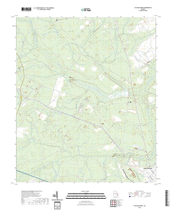
2024 Map of Taylors Creek
USGS Topo · Published 2024About this map
Fort Stewart encompasses the vast majority of this landscape along the border of Long Co and Liberty Co, where the natural drainage of Canoochee Creek and Taylors Creek dictates the terrain. The presence of the military reservation has preserved large tracts of wetlands and forested bays, including Cedar Bay and Strum Bay, while simultaneously overlaying a structured grid of range roads and avenues like Gulick Ave and Wilson Ave. For those tracing local families, the map identifies small, isolated burial grounds such as Todd - Ray Cem and Taylors Creek Cem, which remain as physical markers of the area's rural history before the establishment of the military installation. The intersection of traditional geography, like Sandy Swamp and Gum Branch, with modern federal use creates a unique record of land management in this part of Georgia.
Find a feature on this map
20 named features on this map. Tap any name to fly to it.
Don’t see what you’re looking for? This feature index may not catch every label — zoom into the map to look around manually.
Map Details
Editions of this 2024 Taylors Creek Map
This is the sole edition of this map. No revisions or reprints were ever made.
Other maps of this area

1918 · Hinesville
USGS Topo · 1:62,500

1919 · Claxton
USGS Topo · 1:62,500

1920 · Pembroke
USGS Topo · 1:62,500

1920 · Glennville
USGS Topo · 1:62,500

1944 · Claxton
USGS Topo · 1:62,500

1944 · Glennville
USGS Topo · 1:62,500

1944 · Hinesville
USGS Topo · 1:62,500

1946 · Brunswick
USGS Topo · 1:250,000

1947 · Savannah
USGS Topo · 1:250,000

1948 · Brunswick
USGS Topo · 1:250,000