Loading...
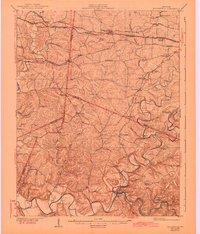
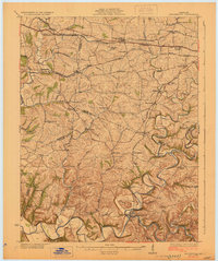
Loading map...1929 Map of Taylorsville
USGS Topo · Published 1943About this map
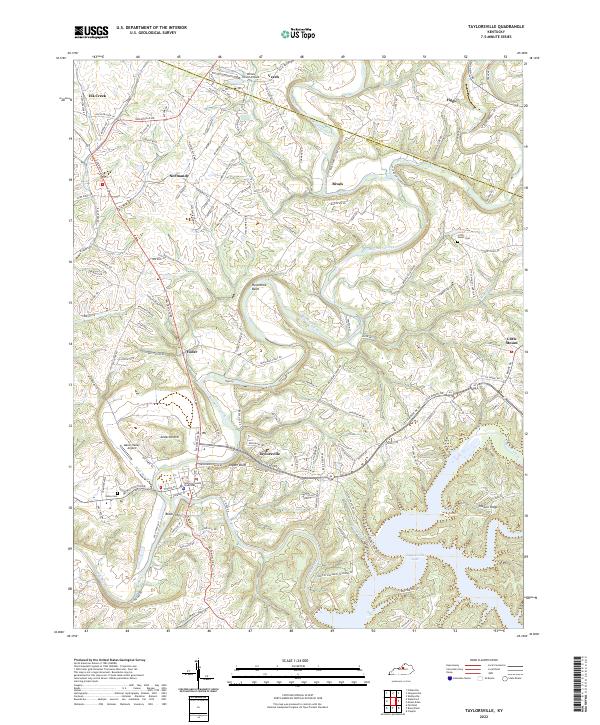
The Salt River and its winding tributaries define the landscape of this region during the early twentieth century, anchoring the seat of Taylorsville. The map reveals a highly developed rural infrastructure of small schoolhouses and churches that served scattered farming communities before modern consolidation. Numerous educational landmarks, including Beechwood School, Plum Creek School, and Foreman School, are situated along the ridges and creek valleys, while congregational life is marked by Shiloh Church and Kings Church.
Find a feature on this map
69 named features on this map. Tap any name to fly to it.
Don’t see what you’re looking for? This feature index may not catch every label — zoom into the map to look around manually.
Map Details
Date Portrayed1929
Date Published1943
PublisherU.S. Geological Survey
Map TypeTopographic
Scale1:62,500
Physical Dimensions17 x 19.9 inches
Editions of this 1929 Taylorsville Map
2 editions found
Historical Maps of Louisville Through Time
8 maps found


Featured Locations
Source Details
SourceU.S. Geological Survey
CopyrightPublic Domain