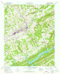
1943 Map of Tazewell
USGS Topo · Published 1973About this map
The town of Tazewell serves as a central hub for this Claiborne County landscape, situated where the ridge-and-valley topography meets the upper reaches of Norris Lake. The map reveals a community defined by its proximity to both agricultural lands and the industrial heritage of the Southern railroad line. Significant infrastructure includes the Greer Tunnel and Sycamore Tunnel, which facilitate rail travel through the challenging terrain of Lone Mountain and Middle Ridge.
Find a feature on this map
80 named features on this map. Tap any name to fly to it.
Don’t see what you’re looking for? This feature index may not catch every label — zoom into the map to look around manually.
Map Details
Editions of this 1943 Tazewell Map
3 editions found
Other maps of this area

1883 · Morristown
USGS Topo · 1:125,000

1886 · Cumberland Gap
USGS Topo · 1:125,000

1887 · Jonesville
USGS Topo · 1:125,000

1888 · Cumberland Gap
USGS Topo · 1:125,000

1891 · Cumberland Gap
USGS Topo · 1:125,000

1891 · Jonesville
USGS Topo · 1:125,000

1893 · Morristown
USGS Topo · 1:125,000

1895 · Morristown
USGS Topo · 1:125,000

1897 · Maynardville
USGS Topo · 1:125,000

1900 · Maynardville
USGS Topo · 1:125,000