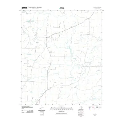
2010 Map of Tecula
USGS Topo · Published 2010About this map
The North Jacksonville Oil Field defines much of the western landscape in this area south of Bullard, where petroleum extraction exists alongside a complex network of creeks and small reservoirs. The settlement of Mixon serves as a local hub near the intersection of FM 177 and FM 3052, while the namesake community of Tecula is situated further south, marked by the Tecula Cemetery. The geography is heavily influenced by the drainage of Bear Creek and Mud Creek, which feed numerous named bodies of water including Bullard Club Lake, Stockton Lake, and Twin Lakes. This pattern of small-scale impoundments suggests a landscape managed for both recreation and local resource control. Smaller locales such as Brushy and Gould anchor the eastern portions of the map, connected by a web of county roads and farm-to-market routes that navigate the undulating terrain near Rocky Point.
Find a feature on this map
64 named features on this map. Tap any name to fly to it.
Don’t see what you’re looking for? This feature index may not catch every label — zoom into the map to look around manually.
Map Details
Editions of this 2010 Tecula Map
This is the sole edition of this map. No revisions or reprints were ever made.
Other maps of this area

1937 · Troupe
USGS Topo · 1:48,000

1943 · Troup
USGS Topo · 1:62,500

1943 · Rusk
USGS Topo · 1:62,500

1945 · Rusk
USGS Topo · 1:62,500

1946 · Bullard
USGS Topo · 1:62,500

1948 · Bullard
USGS Topo · 1:62,500

1951 · Jacksonville
USGS Topo · 1:62,500

1953 · Palestine
USGS Topo · 1:250,000

1956 · Tyler
USGS Topo · 1:250,000

1957 · Palestine
USGS Topo · 1:250,000