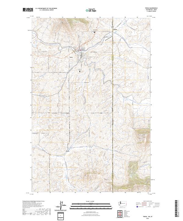
2023 Map of Tekoa
USGS Topo · Published 2023About this map
Tekoa anchors this part of Whitman County, situated in a valley between Tekoa Mtn and the rolling uplands of the Palouse. The town's layout follows a grid along Railroad Ave and E Main St, reflecting its history as a regional transportation hub where the Palouse To Cascades State Park Trl now traverses former rail beds. This survey highlights the intricate drainage network of Hangman Creek and its many tributaries, including Cabbage Creek and Willow Creek, which have carved deep patterns into the landscape.
Find a feature on this map
71 named features on this map. Tap any name to fly to it.
Don’t see what you’re looking for? This feature index may not catch every label — zoom into the map to look around manually.
Map Details
Editions of this 2023 Tekoa Map
This is the sole edition of this map. No revisions or reprints were ever made.
Other maps of this area

1903 · Oakesdale
USGS Topo · 1:125,000

1905 · Oakesdale
USGS Topo · 1:125,000

1954 · Fairfield
USGS Topo · 1:62,500

1955 · Spokane
USGS Topo · 1:250,000

1957 · Plummer
USGS Topo · 1:62,500

1957 · Tensed
USGS Topo · 1:62,500

1958 · Spokane
USGS Topo · 1:250,000

1964 · Oakesdale
USGS Topo · 1:24,000

1964 · Tekoa
USGS Topo · 1:24,000
1964 · Garfield
USGS Topo · 1:24,000