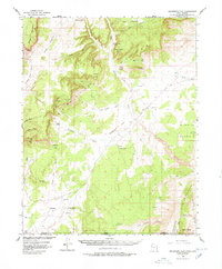
1954 Map of Telegraph Flat
USGS Topo · Published 1978About this map
The Utah Arizona border region is defined by a landscape of stark high-desert formations and isolated ranching operations. In the early 1950s, this area of Kane Co, Utah, and Coconino Co, Arizona, featured a scattered network of homesteads like Clark Ranch and Jepson Ranch, many of which were accessed only by unnamed jeep trails. The geological character of the region is punctuated by the massive White Cliffs and the distinctive ridgeline of The Cockscomb to the southeast. Water management is central to the human footprint here, evidenced by the numerous reservoirs and named washes such as Telegraph Wash and Kitchen Corral Wash. The presence of the School Section Ranch suggests the historical importance of designated state land parcels in the development of these remote borderlands.
Find a feature on this map
46 named features on this map. Tap any name to fly to it.
Don’t see what you’re looking for? This feature index may not catch every label — zoom into the map to look around manually.
Map Details
Editions of this 1954 Telegraph Flat Map
3 editions found

Other maps of this area

1886 · Kanab
USGS Topo · 1:250,000

1886 · Escalante
USGS Topo · 1:250,000

1886 · Echo Cliffs
USGS Topo · 1:250,000

1886 · Kaibab
USGS Topo · 1:250,000

1891 · Echo Cliffs
USGS Topo · 1:250,000

1953 · Cedar City
USGS Topo · 1:250,000

1953 · Grand Canyon
USGS Topo · 1:250,000

1954 · Buckskin Gulch NW
USGS Topo · 1:24,000

1954 · Buckskin Gulch NE
USGS Topo · 1:24,000

1954 · Buckskin Gulch SE
USGS Topo · 1:24,000