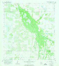
1956 Map of Telegraph Swamp
USGS Topo · Published 1974About this map
Telegraph Swamp dominates this landscape along the border of Charlotte and Lee counties, forming a complex drainage network characterized by seasonal wetlands and dense woodland. The presence of Currys Lake at the heart of the swamp highlights the hydrological character of the region during the mid-20th century. Local water management and early infrastructure are evident through multiple Flowing Wells and a Flowing Well scattered across the western sections, while Babcock Ranch appears in the northern reaches of the survey area. Transport and land use history are etched into the terrain by an Old Railroad Grade running north-south, providing a physical record of former logging or industrial access through the varied drainage of Trout Creek and Telegraph Creek.
Find a feature on this map
15 named features on this map. Tap any name to fly to it.
Don’t see what you’re looking for? This feature index may not catch every label — zoom into the map to look around manually.
Map Details
Editions of this 1956 Telegraph Swamp Map
3 editions found
Other maps of this area

1956 · Telegraph Swamp
USGS Topo · 1:24,000

1956 · Telegraph Swamp NE
USGS Topo · 1:24,000

1956 · Telegraph Swamp NW
USGS Topo · 1:24,000

1956 · Bermont
USGS Topo · 1:24,000

1956 · West Palm Beach
USGS Topo · 1:250,000

1957 · West Palm Beach
USGS Topo · 1:250,000

1957 · Tuckers Corner
USGS Topo · 1:24,000

1957 · Telegraph Swamp SE
USGS Topo · 1:24,000

1958 · West Palm Beach
USGS Topo · 1:250,000

1958 · Olga
USGS Topo · 1:24,000