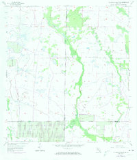
1957 Map of Telegraph Swamp SE
USGS Topo · Published 1974About this map
Jacks Branch and its companion, Jacks Lake, anchor this South Florida landscape where the borders of Charlotte, Glades, Lee, and Hendry counties converge. Surveyed in the late 1950s and updated with aerial data in the early 1970s, the map reveals a transition from natural wetlands to organized land use. The presence of the Plowing Well and various drainage features indicates the early efforts to manage the water table in this low-lying region.
Find a feature on this map
11 named features on this map. Tap any name to fly to it.
Don’t see what you’re looking for? This feature index may not catch every label — zoom into the map to look around manually.
Map Details
Editions of this 1957 Telegraph Swamp SE Map
3 editions found
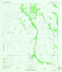
Other maps of this area

1956 · Telegraph Swamp
USGS Topo · 1:24,000

1956 · Telegraph Swamp NE
USGS Topo · 1:24,000

1956 · Telegraph Swamp NW
USGS Topo · 1:24,000

1956 · West Palm Beach
USGS Topo · 1:250,000

1957 · West Palm Beach
USGS Topo · 1:250,000

1957 · Telegraph Swamp SE
USGS Topo · 1:24,000

1958 · West Palm Beach
USGS Topo · 1:250,000

1958 · La Belle NW
USGS Topo · 1:24,000

1958 · Olga
USGS Topo · 1:24,000

1958 · Alva
USGS Topo · 1:24,000