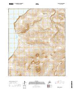
2017 Map of Teller A-3 NW
USGS Topo · Published 2017About this map
Port Clarence defines the western edge of this coastal landscape on the Seward Peninsula, where the saltwater meet the mouths of numerous drainage systems. The northern portion of the map centers on the infrastructure supporting the community of Teller, specifically the Teller Airport and the transition of the Nome-Teller Highway/Bob Blodgett Highway as it follows the coastal terrace. South of Cape Riley, the terrain rises toward the interior highlands, marked by the prominent Coyote Creek Dome.
Find a feature on this map
20 named features on this map. Tap any name to fly to it.
Don’t see what you’re looking for? This feature index may not catch every label — zoom into the map to look around manually.
Map Details
Editions of this 2017 Teller A-3 NW Map
This is the sole edition of this map. No revisions or reprints were ever made.
Other maps of this area

1950 · Teller
USGS Topo · 1:250,000

1950 · Teller B-4
USGS Topo · 1:63,360

1950 · Teller A-3
USGS Topo · 1:63,360

1950 · Teller A-4
USGS Topo · 1:63,360

1950 · Teller B-3
USGS Topo · 1:63,360

1951 · Teller
USGS Topo · 1:250,000

1957 · Teller
USGS Topo · 1:250,000

1958 · Teller
USGS Topo · 1:250,000
2014 · Teller B-3 SE
USGS Topo · 1:25,000
2014 · Teller B-3 SW
USGS Topo · 1:25,000