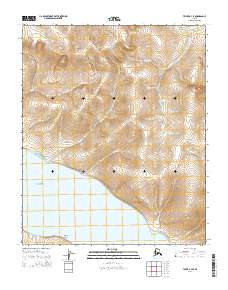
2014 Map of Teller B-3 SE
USGS Topo · Published 2014About this map
Port Clarence defines the southern shoreline of this coastal landscape near the tip of the Seward Peninsula. The terrain is marked by distinct peaks including Mukacharni Mountain and Eva Mountain, which anchor a complex drainage system flowing toward the coast. A series of named waterways, such as Lombard Cr, Sunset Cr, and Moonlight Cr, carve through the uplands before reaching the salt water. The coastal profile is further distinguished by Sixmile Point, a prominent landmark on the inlet. The map detail reflects a remote wilderness environment where natural landforms and watercourses serve as the primary identifiers, illustrating the geographical isolation of this region during the early twenty-first century.
Find a feature on this map
26 named features on this map. Tap any name to fly to it.
Don’t see what you’re looking for? This feature index may not catch every label — zoom into the map to look around manually.
Map Details
Editions of this 2014 Teller B-3 SE Map
This is the sole edition of this map. No revisions or reprints were ever made.
Other maps of this area

1950 · Teller
USGS Topo · 1:250,000

1950 · Teller A-2
USGS Topo · 1:63,360

1950 · Teller B-2
USGS Topo · 1:63,360

1950 · Teller A-3
USGS Topo · 1:63,360

1950 · Teller B-3
USGS Topo · 1:63,360

1951 · Teller
USGS Topo · 1:250,000

1957 · Teller
USGS Topo · 1:250,000

1958 · Teller
USGS Topo · 1:250,000
2014 · Teller B-2 SW
USGS Topo · 1:25,000
2014 · Teller B-2 NW
USGS Topo · 1:25,000