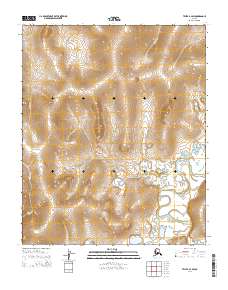
2014 Map of Teller B-2 SW
USGS Topo · Published 2014About this map
Agiapuk River meanders across this Seward Peninsula landscape, creating a complex network of oxbows and wetlands in the southeastern portion of the map. The terrain is defined by a series of drainages, including Flat Cr, Offield Cr, and Eureka Cr, which carve through the high ground. The survey clearly delineates the Public Land Survey System grid, spanning Townships 1 through 3 South across Ranges 35 and 36 West. In the northern reaches, smaller tributaries such as Nickle Cr, Mitchell Cr, and North Cr drain the higher elevations. This map provides a detailed view of the natural hydrology and topographical contours of the region before further modern development, reflecting the untouched character of this Alaskan wilderness during the early 21st century.
Find a feature on this map
13 named features on this map. Tap any name to fly to it.
Don’t see what you’re looking for? This feature index may not catch every label — zoom into the map to look around manually.
Map Details
Editions of this 2014 Teller B-2 SW Map
This is the sole edition of this map. No revisions or reprints were ever made.
Other maps of this area

1950 · Teller
USGS Topo · 1:250,000

1950 · Teller A-2
USGS Topo · 1:63,360

1950 · Teller B-2
USGS Topo · 1:63,360

1950 · Teller A-3
USGS Topo · 1:63,360

1950 · Teller B-3
USGS Topo · 1:63,360

1951 · Teller
USGS Topo · 1:250,000

1957 · Teller
USGS Topo · 1:250,000

1958 · Teller
USGS Topo · 1:250,000
2014 · Teller B-2 SE
USGS Topo · 1:25,000
2014 · Teller B-2 NW
USGS Topo · 1:25,000