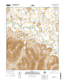
2014 Map of Teller B-2 NW
USGS Topo · Published 2014About this map
The Agiapuk River meanders across this interior landscape on the Seward Peninsula, joined by a complex network of tributaries including American River and Boulder Cr. This 2014 survey captures a terrain defined by high-elevation drainage patterns, where the land transitions from the high ridges above Mitchell Cr to the expansive wetlands of the river valley. The map reveals the hydrologic character of the region, tracing the paths of Homestake Cr and North Cr as they feed the primary river system. This area, largely defined by its natural watercourses and the lack of developed roads, reflects the enduring character of the Alaskan wilderness near the Bering Strait. Researchers of the region's geography will find interest in the precise contouring of the uplands surrounding Saturday Cr and Nickle Cr, which illustrate the complex watershed that sustains this environment.
Find a feature on this map
13 named features on this map. Tap any name to fly to it.
Don’t see what you’re looking for? This feature index may not catch every label — zoom into the map to look around manually.
Map Details
Editions of this 2014 Teller B-2 NW Map
This is the sole edition of this map. No revisions or reprints were ever made.
Other maps of this area

1950 · Teller
USGS Topo · 1:250,000

1950 · Teller B-2
USGS Topo · 1:63,360

1950 · Teller C-3
USGS Topo · 1:63,360

1950 · Teller C-2
USGS Topo · 1:63,360

1950 · Teller B-3
USGS Topo · 1:63,360

1951 · Teller
USGS Topo · 1:250,000

1957 · Teller
USGS Topo · 1:250,000

1958 · Teller
USGS Topo · 1:250,000
2014 · Teller C-2 SW
USGS Topo · 1:25,000
2014 · Teller C-3 SE
USGS Topo · 1:25,000