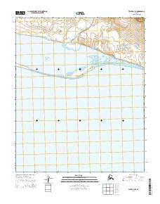
2014 Map of Teller B-4 SE
USGS Topo · Published 2014About this map
Port Clarence and Brevig Lagoon dominate this coastal Alaskan landscape, where the tides of the Seward Peninsula meet the inflow of freshwater streams. The transition from the open waters of the port to the semi-enclosed lagoon is marked by the narrow landform at Point Jackson. Moving inland to the north, the terrain is defined by the drainage patterns of the California River and Fish Creek, which meander through the low-lying tundra before reaching the coast. This 2014 survey documents a quiet maritime environment, illustrating the intersection of large-scale hydrological features in a region where the shoreline is the primary geographic anchor. The absence of road infrastructure or established settlements emphasizes the remote, water-dependent character of the Seward Peninsula's western reaches during this period.
Find a feature on this map
10 named features on this map. Tap any name to fly to it.
Don’t see what you’re looking for? This feature index may not catch every label — zoom into the map to look around manually.
Map Details
Editions of this 2014 Teller B-4 SE Map
This is the sole edition of this map. No revisions or reprints were ever made.
Other maps of this area

1950 · Teller
USGS Topo · 1:250,000

1950 · Teller B-4
USGS Topo · 1:63,360

1950 · Teller A-3
USGS Topo · 1:63,360

1950 · Teller A-4
USGS Topo · 1:63,360

1950 · Teller B-3
USGS Topo · 1:63,360

1951 · Teller
USGS Topo · 1:250,000

1957 · Teller
USGS Topo · 1:250,000

1958 · Teller
USGS Topo · 1:250,000
2014 · Teller B-4 NW
USGS Topo · 1:25,000
2014 · Teller B-3 SW
USGS Topo · 1:25,000