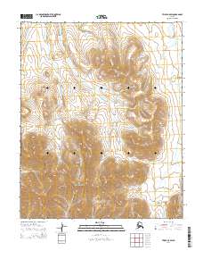
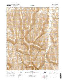
2014 Map of Teller C-5 SW
USGS Topo · Published 2014About this map
The Continental Divide winds across the high ridges of the Seward Peninsula in this 2014 study of the Alaskan wilderness near the Bering Strait. This high-altitude landscape is dominated by the western extent of the York Mountains, where steep drainages feed multiple river systems. To the east, the Mint River flows through broad valleys, while the Anikovik River and its various tributaries, including Banner Cr, drain the western slopes. The lack of roads or established settlements on this sheet highlights the isolation of this terrain, where the topography is defined entirely by the intricate network of creeks like Skookum Cr, Sterling Cr, and the forks of Buck Creek. This map provides an essential baseline for understanding the drainage patterns and physical geography of the Nome region's remote interior before modern shifts in the landscape.
Find a feature on this map
15 named features on this map. Tap any name to fly to it.
Don’t see what you’re looking for? This feature index may not catch every label — zoom into the map to look around manually.
Map Details
Editions of this 2014 Teller C-5 SW Map
This is the sole edition of this map. No revisions or reprints were ever made.
Other maps of this area

1950 · Teller
USGS Topo · 1:250,000

1950 · Teller C-6
USGS Topo · 1:63,360
1950 · Teller B-5
USGS Topo · 1:63,360

1950 · Teller C-5
USGS Topo · 1:63,360
1950 · Teller B-6
USGS Topo · 1:63,360

1951 · Teller
USGS Topo · 1:250,000

1957 · Teller
USGS Topo · 1:250,000

1958 · Teller
USGS Topo · 1:250,000
2014 · Teller B-5 NE
USGS Topo · 1:25,000
2014 · Teller C-5 NE
USGS Topo · 1:25,000