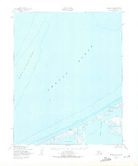
1950 Map of Teller D-6
USGS Topo · Published 1975About this map
The remote coastline along the Arctic Ocean northwest of Nome is defined by the narrow sandspits and barrier islands that separate the sea from the expansive Lopp Lagoon. This mid-century survey reveals a seasonal landscape tied to subsistence and travel, marked by the presence of a Winter Trail running parallel to the shore. Small coastal points and seasonal sites like Sin-i-Rock and Ah-Gude Le-Rock highlight the sparse but significant human presence in this high-latitude environment. To the north and east, the lagoon system is punctuated by small settlements such as Mitletukeruk and Mit-Le-Topik. The offshore waters are dominated by the Prince of Wales Shoal, a major underwater feature that dictated maritime navigation in the Seward Peninsula region during this era. An Emergency Landing Strip located near the lagoon shore provides a clear indication of the area's strategic and logistical importance in the post-war period.
Find a feature on this map
9 named features on this map. Tap any name to fly to it.
Don’t see what you’re looking for? This feature index may not catch every label — zoom into the map to look around manually.
Map Details
Editions of this 1950 Teller D-6 Map
3 editions found
Other maps of this area

1950 · Teller
USGS Topo · 1:250,000

1950 · Shishmaref
USGS Topo · 1:250,000

1950 · Teller C-6
USGS Topo · 1:63,360
1950 · Teller C-7
USGS Topo · 1:63,360

1950 · Teller D-5
USGS Topo · 1:63,360
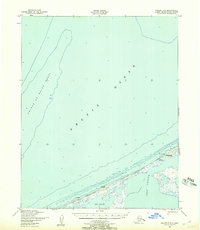
1950 · Teller D-6
USGS Topo · 1:63,360

1950 · Teller C-5
USGS Topo · 1:63,360

1951 · Shishmaref
USGS Topo · 1:250,000

1951 · Teller
USGS Topo · 1:250,000

1957 · Teller
USGS Topo · 1:250,000