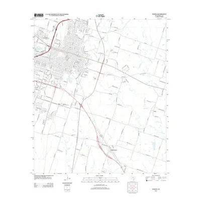
2012 Map of Temple
USGS Topo · Published 2012About this map
The rail-and-creek landscape of Bell County is anchored here by the expanding city of Temple and the outlying settlements of Heidenheimer and Oscar. This 2012 survey shows the convergence of vital local waterways, including Knob Cr, Boggy Cr, and Little Elm Cr, which define the drainage patterns south of the metropolitan center. Educational and agricultural institutions are prominently marked, with the Temple Coll campus in the city and the extensive Blackland Experimental Farm situated to the southwest. Genealogists will find a concentration of local burial grounds, ranging from Evergreen Cem and Hillcrest Cem near the city center to more rural locations like Greathouse Cem and Wedel Cem. The map illustrates the transition from the dense urban grid of Gober and central Temple to the agricultural plains of eastern Bell County, where Cottonwood Cr winds through open country toward Little Flock.
Find a feature on this map
172 named features on this map. Tap any name to fly to it.
Don’t see what you’re looking for? This feature index may not catch every label — zoom into the map to look around manually.
Map Details
Editions of this 2012 Temple Map
This is the sole edition of this map. No revisions or reprints were ever made.
Other maps of this area

1885 · Taylor
USGS Topo · 1:125,000

1887 · Taylor
USGS Topo · 1:125,000

1892 · Temple
USGS Topo · 1:125,000

1894 · Taylor
USGS Topo · 1:125,000

1924 · Temple 3-C
USGS Topo · 1:48,000

1924 · Temple 3-B
USGS Topo · 1:48,000

1931 · Belton
USGS Topo · 1:62,500

1954 · Waco
USGS Topo · 1:250,000

1954 · Austin
USGS Topo · 1:250,000

1955 · Waco
USGS Topo · 1:250,000